Cohagen, Montana
Unincorporated community in Montana, United States
47°3′16″N 106°37′3″W / 47.05444°N 106.61750°W / 47.05444; -106.6175059322
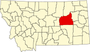
Cohagen is an unincorporated community in southeastern Garfield County, Montana, United States. It lies along Highway 59 southeast of the town of Jordan, the county seat of Garfield County.[1] Its elevation is 2,720 feet (829 m).[2]
History
Cohagen's post office, with the ZIP code of 59322,[3] opened on August 18, 1905.[4] The town name is the mother's maiden name of the first postmaster Harry Harris.[5]
In September 2020, Cohagen was evacuated due to wildfire threat.[6]
Climate
According to the Köppen Climate Classification system, Cohagen has a semi-arid climate, abbreviated "BSk" on climate maps.[7]
| Climate data for Cohagen, Montana, 1991–2020 normals, extremes 1967–present | |||||||||||||
|---|---|---|---|---|---|---|---|---|---|---|---|---|---|
| Month | Jan | Feb | Mar | Apr | May | Jun | Jul | Aug | Sep | Oct | Nov | Dec | Year |
| Record high °F (°C) | 68 (20) | 74 (23) | 83 (28) | 91 (33) | 102 (39) | 109 (43) | 110 (43) | 109 (43) | 106 (41) | 93 (34) | 80 (27) | 81 (27) | 110 (43) |
| Mean maximum °F (°C) | 52.3 (11.3) | 55.7 (13.2) | 69.1 (20.6) | 78.7 (25.9) | 86.4 (30.2) | 94.7 (34.8) | 100.4 (38.0) | 99.5 (37.5) | 94.9 (34.9) | 82.0 (27.8) | 67.3 (19.6) | 54.6 (12.6) | 102.2 (39.0) |
| Mean daily maximum °F (°C) | 30.7 (−0.7) | 34.1 (1.2) | 46.1 (7.8) | 56.9 (13.8) | 66.7 (19.3) | 76.1 (24.5) | 85.8 (29.9) | 85.1 (29.5) | 73.8 (23.2) | 58.3 (14.6) | 43.7 (6.5) | 32.9 (0.5) | 57.5 (14.2) |
| Daily mean °F (°C) | 18.7 (−7.4) | 21.9 (−5.6) | 32.8 (0.4) | 42.9 (6.1) | 52.6 (11.4) | 61.9 (16.6) | 69.8 (21.0) | 68.4 (20.2) | 57.7 (14.3) | 44.3 (6.8) | 30.9 (−0.6) | 20.9 (−6.2) | 43.6 (6.4) |
| Mean daily minimum °F (°C) | 6.8 (−14.0) | 9.8 (−12.3) | 19.4 (−7.0) | 28.8 (−1.8) | 38.5 (3.6) | 47.8 (8.8) | 53.8 (12.1) | 51.8 (11.0) | 41.5 (5.3) | 30.3 (−0.9) | 18.2 (−7.7) | 9.0 (−12.8) | 29.6 (−1.3) |
| Mean minimum °F (°C) | −23.7 (−30.9) | −15.0 (−26.1) | −4.3 (−20.2) | 15.4 (−9.2) | 23.7 (−4.6) | 36.8 (2.7) | 44.3 (6.8) | 38.6 (3.7) | 26.4 (−3.1) | 12.5 (−10.8) | −7.2 (−21.8) | −17.6 (−27.6) | −30.1 (−34.5) |
| Record low °F (°C) | −44 (−42) | −42 (−41) | −35 (−37) | −11 (−24) | 13 (−11) | 28 (−2) | 36 (2) | 28 (−2) | 13 (−11) | −16 (−27) | −29 (−34) | −46 (−43) | −46 (−43) |
| Average precipitation inches (mm) | 0.31 (7.9) | 0.28 (7.1) | 0.42 (11) | 1.11 (28) | 2.33 (59) | 2.27 (58) | 1.61 (41) | 1.12 (28) | 1.12 (28) | 1.06 (27) | 0.40 (10) | 0.31 (7.9) | 12.34 (312.9) |
| Average snowfall inches (cm) | 5.2 (13) | 3.8 (9.7) | 3.4 (8.6) | 2.1 (5.3) | 0.6 (1.5) | 0.0 (0.0) | 0.0 (0.0) | 0.0 (0.0) | 0.0 (0.0) | 1.2 (3.0) | 3.1 (7.9) | 5.2 (13) | 24.6 (62) |
| Average precipitation days (≥ 0.01 in) | 4.3 | 4.2 | 5.0 | 6.3 | 9.0 | 9.2 | 6.6 | 4.8 | 5.2 | 5.5 | 4.1 | 3.3 | 67.5 |
| Average snowy days (≥ 0.1 in) | 2.6 | 2.6 | 1.8 | 0.7 | 0.2 | 0.0 | 0.0 | 0.0 | 0.1 | 0.6 | 1.7 | 2.4 | 12.7 |
| Source 1: NOAA[8] | |||||||||||||
| Source 2: National Weather Service[9] | |||||||||||||
References
- ^ McNally, Rand (2008). The Road Atlas '08. Chicago: Rand McNally. p. 61.
- ^ U.S. Geological Survey Geographic Names Information System: Cohagen, Montana
- ^ "Zip Code Lookup". Archived from the original on June 15, 2011.
- ^ U.S. Geological Survey Geographic Names Information System: Cohagen Post Office
- ^ "Cohagen". Montana Place Names Companion. Montana Historical Society. Retrieved April 2, 2021.
- ^ "Alert for Garfield (Montana) Issued by the National Weather Service". September 2, 2020.
- ^ "Climate Summary for Cohagen, Montana".
- ^ "U.S. Climate Normals Quick Access – Station: Cohagen, MT". National Oceanic and Atmospheric Administration. Retrieved March 8, 2023.
- ^ "NOAA Online Weather Data – NWS Glasgow". National Weather Service. Retrieved March 8, 2023.
- v
- t
- e
Municipalities and communities of Garfield County, Montana, United States
County seat: Jordan
communities
- Brusett
- Cohagen
- Mosby
- Sand Springs
- Montana portal
- United States portal
 | This Garfield County, Montana state location article is a stub. You can help Wikipedia by expanding it. |
- v
- t
- e


