Halpin Covered Bridge
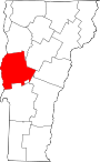
Bridge in Middlebury, Vermont
44°03′00″N 73°08′28″W / 44.05°N 73.141°W / 44.05; -73.141


The Halpin Covered Bridge, also called the High Covered Bridge,[2] is a wooden covered bridge carrying Halpin Bridge Road across the Muddy Branch of the New Haven River in Middlebury, Vermont. It was listed on the National Register of Historic Places in 1974.[1]
Description and history
The Halpin Covered Bridge is located in a rural area of northern Middlebury, near or on the border with neighboring New Haven on Halpin Bridge Road, a dead-end road off Halpin Road. The bridge spans a gorge carrying the Muddy Branch of the New Haven River, and now provides access only to the Halpin family farm. It is a single-span Town lattice truss, 66 feet (20 m) long, resting on concrete abutments. Its total width is 16 feet (4.9 m), with a roadway width of 12 feet 5 inches (3.78 m) (one lane). The bridge stands 41 feet (12.5 m) above the water, making it the highest covered bridge in the state.[3]
The bridge was originally built to serve a marble quarry operation on the east side of the river, and had dry laid stone abutments. It is one of only two covered bridges in Middlebury. It had minor repairs made in the 1960s. In 1994 the bridge had extensive work done by Jan Lewandoski, in which the bridge was completely removed from its crumbling marble abutments, and new concrete abutments were created for it.[2]
See also
- National Register of Historic Places listings in Addison County, Vermont
- List of Vermont covered bridges
- List of bridges on the National Register of Historic Places in Vermont
References
- ^ a b "National Register Information System". National Register of Historic Places. National Park Service. July 9, 2010.
- ^ a b Evans, Benjamin and June. New England's Covered Bridges. University Press of New England, 2004. ISBN 1-58465-320-5
- ^ Hugh Henry (1974). "NRHP nomination for John Hamilton Farmstead". National Park Service. Retrieved 2016-09-13. with photos from 1974
- v
- t
- e
Historic
Landmark
- Robert Frost Farm
- Mount Independence
- Rokeby
- Emma Willard House
- Bristol Downtown Historic District
- Camp Marbury Historic District
- Colonel Ephraim and Sarah Doolittle Farm
- Fenn Farm
- Field Farm
- John Hamilton Farmstead
- The Heights
- Middlebury Village Historic District
- Salisbury Fish Hatchery
- Shard Villa
- University of Vermont Morgan Horse Farm
- Vergennes Historic District
- Vergennes Residential Historic District
- Witherell Farm
| Commercial | |
|---|---|
| Educational |
|
| Government | |
| Industrial |
|
| Religious |
|
| Residential | |
| Transportation |
- Orwell Site
† This entry has been removed from the register.
| Authority control databases |
|
|---|


