Kincardine O'Neil
Human settlement in Scotland


Kincardine O'Neil
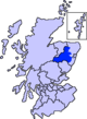
Location within Aberdeenshire
- Aberdeenshire
- Aberdeenshire
- West Aberdeenshire and Kincardine
- Aberdeenshire West
Kincardine O'Neil (Scottish Gaelic: Cinn Chàrdainn, Scots: Kinker) is a village in Aberdeenshire, Scotland. It is situated between the towns of Banchory and Aboyne approximately 25 miles (40 km) west of Aberdeen on the north bank of the River Dee.

Etymology
The village was formerly known as Eaglais Iarach (Church of St Irchard/Erchard) in Scots Gaelic.[1]
The O'Neil suffix is likely to originate from the ancient Barony of Onele/O'Neill which was gifted to Donnchadh IV, Earl of Fife by Robert the Bruce in 1315.[2]
Area history
Since ancient times there was a crossing of the Dee River at Kincardine O'Neil.[3] Locations of the Dee crossings along with alignment of ancient trackways formed a major impetus for location of early castles and settlements. In the vicinity of Kincardine O'Neil the Middle Ages trackways to the south had a particular influence on development in and around Kincardine O'Neil and Aboyne Castle.[4]
Saint Irchard, a medieval bishop of the Picts, was born in Kincardine O'Neil.[5]
In the 19th century, the Deeside Railway bypassed the village, impeding the expansion of the settlement, unlike towns nearby. By 1895 the population of Kincardine O'Neil exceeded 200.[6] Most of the extant buildings were built in the 19th century.
The village was designated a conservation area in 1983 and subsequently granted 'outstanding' status in 1995.[7]
Amenities
Kincardine O'Neil is home to a number of shops and services including a traditional village store and post office. The village hall, bowling green and playing field are to the west end of the settlement. There is a curling pond behind the north side of the main street. There is a Scottish Episcopal Church and a primary school. Public toilets are maintained by the local community. The Deeside Way passes through the village.
People associated with Kincardine O'Neil
- John Henry Anderson
- Margaret Bane
- Bill Bradford (British Army officer)
- James Grant Duff
- David Dumbreck
- Alan Durward
- Irchard
- Peter Milne (musician)
- Thomas Reid
- Alexander Ross (poet)
Sister cities
 Thun-Saint-Martin, France

See also
Line notes
- ^ Mac an Tàilleir, Iain. "Ainmean-Àite - K-O" (PDF). The Scottish Parliament. Archived from the original (PDF) on 4 November 2020. Retrieved 3 November 2020.
- ^ "Document 1/53/528 (RMS, i, App. 1, no. 68)". People of Medieval Scotland. Retrieved 29 July 2021.
- ^ Kincardine O'Neil historical profile
- ^ Hogan, 2007
- ^ Barrett, Dom Michael (18 July 2020), A Calendar of Scotish Saints, BoD – Books on Demand, p. 50, ISBN 978-3-7523-2290-3, retrieved 15 July 2021
- ^ Mackintosh, 1895
- ^ "Aberdeenshire Council, Marr Area Conservation Areas" (PDF). Retrieved 20 July 2021.
References
- C. Michael Hogan, Elsick Mounth, Megalithic Portal, ed A. Burnham [2]
- John Mackintosh, History of the Valley of the Dee, from the Earliest Times to the Present Day, 1895, Taylor and Henderson, 240 pages
- Kincardine O'Neil historical profile
External sources
Wikimedia Commons has media related to Kincardine O'Neil.
- Kincardine O'Neil Homepage
- v
- t
- e
Settlements and places of interest in Marr, Aberdeenshire
- Backburn
- Bellabeg
- Birse
- Birsemore
- Bogniebrae
- Brathens
- Brideswell
- Cairnie
- Corgarff
- Crathie
- Dinnet
- Finzean
- Forgue
- Gartly
- Inverey
- Keig
- Kennethmont
- Kildrummy
- Kincardine O'Neil
- Kirkton of Tough
- Logie Coldstone
- Lost
- Lumsden
- Monymusk
- Potarch
- Rhynie
- Ruthven
- Strachan
- Strathdon
- Tillyfourie
- Tornaveen
- Towie
- Tullich
- Whitehouse
- Ythanwells
- Alford Valley Railway
- Badenyon
- Balmoral Castle
- Blelack
- Braemar Castle
- Burn O'Vat
- Cairn o' Mount
- Cairngorms National Park
- Castle Forbes
- Corgarff Castle
- Craigievar Castle
- Crathes Castle
- Crathie Kirk
- Forest of Birse
- Grampian Transport Museum
- Huntly Castle
- Kildrummy Castle
- Lochnagar
- Royal Deeside
- Royal Deeside Railway
- Yonder Bognie
- Ythan Wells (Glenmailen) Roman Camp
Areas and primary settlements in Aberdeenshire (see also: Aberdeen City) | ||
|---|---|---|
| in Banff and Buchan |  | |
| in Buchan | ||
| in Formartine | ||
| in Garioch | ||
| in Kincardine and Mearns | ||
| in Marr | ||
 | This Aberdeenshire location article is a stub. You can help Wikipedia by expanding it. |
- v
- t
- e


