Nurobod District, Uzbekistan
District in Samarqand Region, Uzbekistan
Nurobod District | |
|---|---|
District | |
 | |
| Country |  Uzbekistan Uzbekistan |
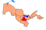
| Region | Samarqand Region |
| Capital | Nurobod |
| Area | |
| • Total | 4,860 km2 (1,880 sq mi) |
| Population (2021) | |
| • Total | 152,700 |
| • Density | 31/km2 (81/sq mi) |
| Time zone | UTC+5 (UZT) |
Nurobod District is a district of Samarqand Region in Uzbekistan. The capital lies at the city Nurobod.[1] It has an area of 4,860 km2 (1,880 sq mi)[2] and its population is 152,700 (2021 est.).[3]
The district consists of one city (Nurobod), one urban-type settlement (Nurbuloq) and 7 rural communities (Jom, Jarquduq, Nurbuloq, Tim, Sazogʻon, Ulus, Tutli).[1]
References
- ^ a b "Classification system of territorial units of the Republic of Uzbekistan" (in Uzbek and Russian). The State Committee of the Republic of Uzbekistan on statistics. July 2020.
- ^ "Samarqand viloyatining ma'muriy-hududiy bo'linishi" [Administrative-territorial division of the Samarqand Region] (PDF) (in Uzbek). Samarqand regional department of statistics.
- ^ "Urban and rural population by district" (PDF) (in Uzbek). Samarkand regional department of statistics.
- v
- t
- e
Samarqand Region
Capital: Samarkand
- Kattakurgan City
- Samarkand City
- Bulungʻur
- Ishtixon
- Jomboy
- Kattakurgan
- Narpay
- Nurobod
- Oqdaryo
- Pastdargʻom
- Paxtachi
- Payariq
- Qoʻshrabot
- Samarqand
- Toyloq
- Urgut
 | This Uzbekistan location article is a stub. You can help Wikipedia by expanding it. |
- v
- t
- e
39°36′34″N 66°17′16″E / 39.609391°N 66.287727°E / 39.609391; 66.287727


