Oxmoor Copse
51°12′34″N 0°25′49″W / 51.2095°N 0.4304°W / 51.2095; -0.4304Area 1.23 hectares (3.0 acres) Administration Governing body Woodland Trust North Downs Greensand Ridge Low Weald Rivers Lakes and ponds Long-distance paths National Cycle Routes
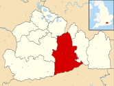
Oxmoor Copse is just south of the village of Abinger Hammer and to the west of the village of Abinger Common, in Surrey. It is 1.23 hectares (3.0 acres) and is in an AONB lying within the Surrey Hills.[1] The previous owners gave the copse to the Woodland Trust as a gift.
The copse lies on Greensand and the soil is acidic. The main trees are mature oaks and hazel; there are also bluebells.[2] A considerable number of trees were blown down in the 1987 storm. Replanting took place in 1991. Arable and pastoral land surrounds the copse. On the fringes of the copse there is a considerable amount of Common Cudweed but generally the copse is species poor.[3]
The grid reference is TQ 090 467
References
External links
- Mole Valley District Council
- v
- t
- e

- Albury Heath
- Blackheath Common
- Colyers Hanger
- Devil's Jumps
- Devil's Punch Bowl
- Frensham Common
- Gibbet Hill
- Gong Hill
- Hankley Common
- Hankley Farm
- Holmbury Hill
- Leith Hill
- Moor Park
- Oxmoor Copse
- Puttenham and Crooksbury Commons
- St Martha's Hill
- Stockstone Quarry
- Thursley Common
- Winterfold Forest
- Witley Common
- Wotton Common
| ||||||||||||||||||
|---|---|---|---|---|---|---|---|---|---|---|---|---|---|---|---|---|---|---|
|
|  | ||||||||||||||||
| Parks | ||||||||||||||||||
| Places of worship | ||||||||||||||||||
| Education | ||||||||||||||||||
| Transport |
| |||||||||||||||||
Buildings and structures | ||||||||||||||||||
| Sport |
| |||||||||||||||||
Places listed are articles notable as settlements, arranged by post town The two principal towns are emboldened | ||||||||||||||||||


