Brandon and Byshottles
 |
| Państwo |  Wielka Brytania Wielka Brytania
|
| Kraj |  Anglia Anglia
|
| Region | North East |
| Hrabstwo | Durham |
Populacja (2011)
• liczba ludności |
18 509
|
Położenie na mapie Durham |
Położenie na mapie Wielkiej Brytanii |
Położenie na mapie Anglii |
 54°45′51″N 1°39′08″W/54,764167 -1,652222 54°45′51″N 1°39′08″W/54,764167 -1,652222 |
 | Multimedia w Wikimedia Commons | |
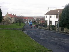
Brandon and Byshottles – civil parish w Anglii, w hrabstwie Durham[1]. Leży 6 km na zachód od miasta Durham i 376 km na północ od Londynu[2]. W 2011 roku civil parish liczyła 18 509 mieszkańców[3].
Przypisy
- ↑ Ordnance Survey linked data
- ↑ Brandon and Byshottles na mapie. getamap.ordnancesurvey.co.uk. [dostęp 2010-11-27]. (ang.).
- ↑ Neighbourhood Statistics. [dostęp 2015-10-19]. [zarchiwizowane z tego adresu (2016-03-04)].
Miejscowości dystryktu Durham (1974–2009)
- Bearpark
- Belmont
- Brancepeth
- Brandon and Byshottles
- Cassop-cum-Quarrington
- Coxhoe
- Croxdale and Hett
- Durham
- Framwellgate Moor
- Kelloe
- Lands cmn to the parishes of Brancepeth and Brandon and Byshottles
- Pittington
- Shadforth
- Sherburn (Sherburn Village)
- Shincliffe
- West Rainton
- Witton Gilbert
|


 54°45′51″N 1°39′08″W/54,764167 -1,652222


